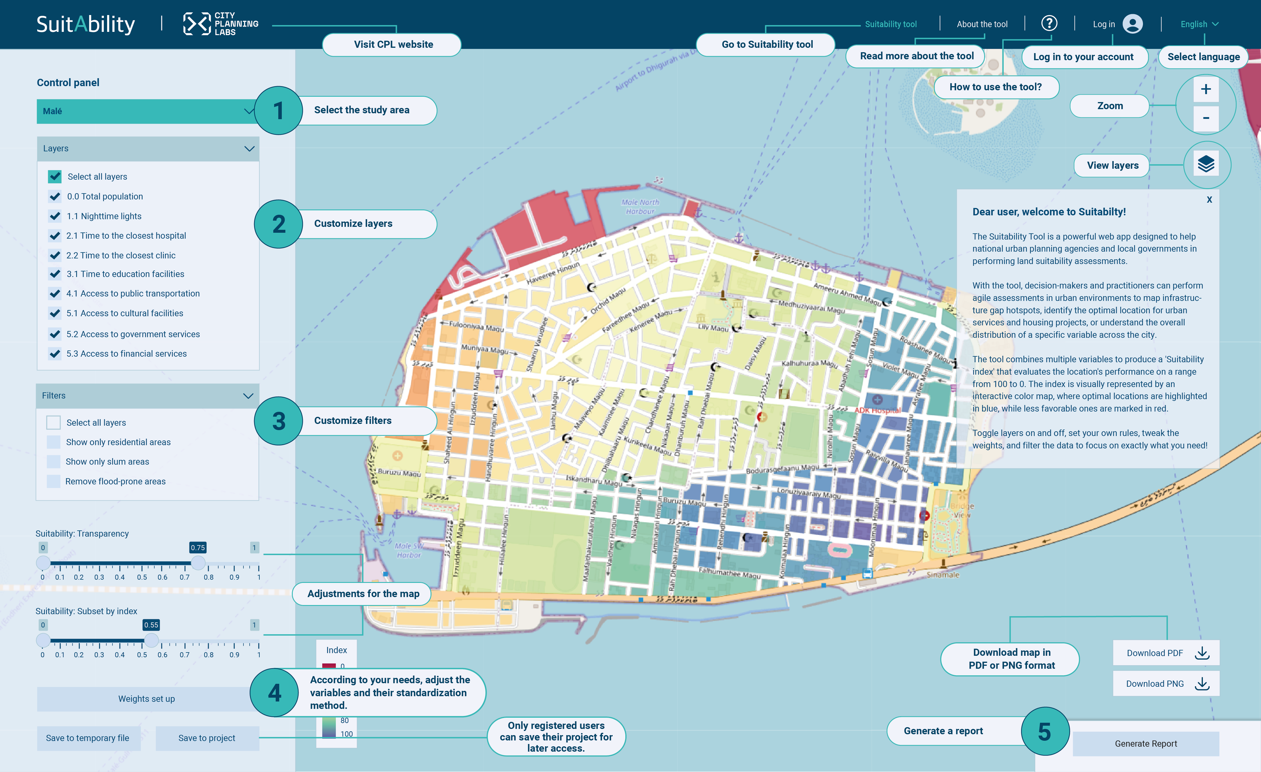
The Suitability Tool is a powerful web app designed to help national urban planning agencies and local governments in performing land suitability assessments.
With the tool, decision-makers and practitioners can perform agile assessments in urban environments to map infrastructure gap hotspots, identify the optimal location for urban services and housing projects, or understand the overall distribution of a specific variable across the city.
The tool combines multiple variables to produce a 'Suitability index' that evaluates the location's performance on a range from 100 to 0. The index is visually represented by an interactive color map, where optimal locations are highlighted in blue, while less favorable ones are marked in red.
Toggle layers on and off, set your own rules, tweak the weights, and filter the data to focus on exactly what you need!
Suitability Tool
Now
This is a demo version. Some functionalities are limited. Please contact us for further information.
Suitability Tool
Now
You're not allowed to perform this action!
Suitability Tool
Now
Action successfully completed!
Are you sure?
This action will override the default setup values. Continue?
Weights set up
Modify the following table to update normalization methods and weighting values.
Go back to “About Suitability” for further information regarding columns in the table.
Id
Name
Weight
Direction
Method
Min
Max
Description
Units
pob_65M
Población de más de 65 años
pob_0A5
Población de 0 a 5 años
pob_dis
Población con alguna discapacidad
viv_sag
Vviendas sin agua entubada
viv_sel
Viviendas sin electricidad
viv_ocu
Viviendas ocupadas
hog_jef
Mujeres jefas de familia
pob_muj_16A60
Población de mujeres de 16 a 60 años
LST_average
Desviación de la media de temperatura
PRO_OCUP_C
Hacinamiento
pob_ssa
Población servicios de salud
EDIT: Only selected layers will appear in the weights set up and the remaining information (e. g. References, Category, and others) will be explained in the “About Suitability”, disposed on the “About the tool” tab.