SuitAbility Tour
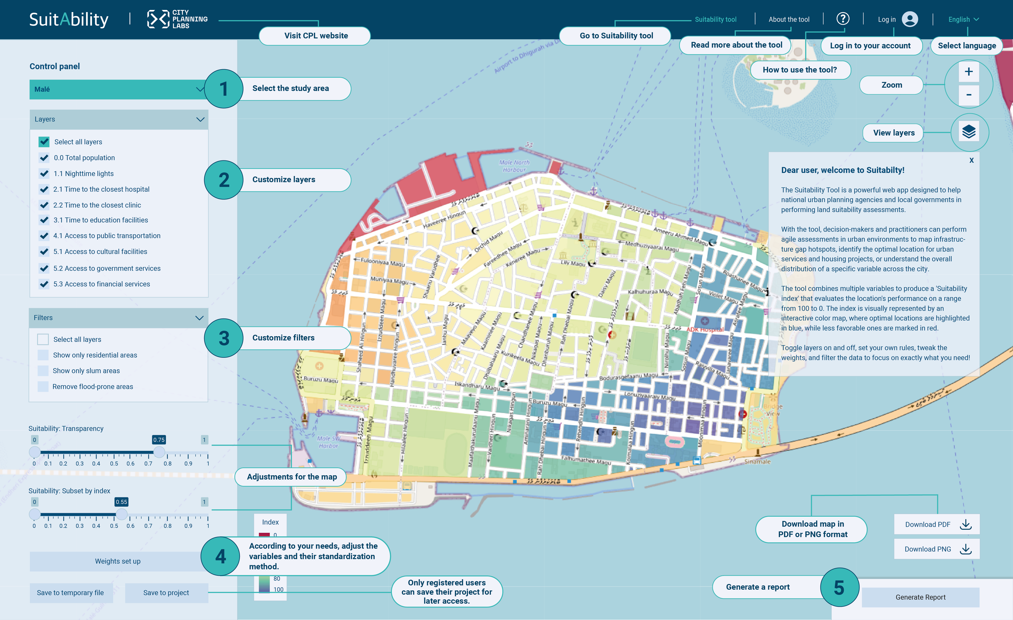
The Suitability Tool is a powerful web app designed to help national urban planning agencies and local governments in performing land suitability assessments.
With the tool, decision-makers and practitioners can perform agile assessments in urban environments to map infrastructure gap hotspots, identify the optimal location for urban services and housing projects, or understand the overall distribution of a specific variable across the city.
The tool combines multiple variables to produce a 'Suitability index' that evaluates the location's performance on a range from 100 to 0. The index is visually represented by an interactive color map, where optimal locations are highlighted in blue, while less favorable ones are marked in red.
Toggle layers on and off, set your own rules, tweak the weights, and filter the data to focus on exactly what you need!
| Project name | Last modified | Description | Options |
|---|---|---|---|
| Querétaro | Sept. 14, 2025, 7:44 p.m. | Sensibilidad y exposición a ICU. Proyecto de la CAME. | |
| Erdenet | Sept. 12, 2025, 6:36 p.m. | Identifying infrastructure gaps in Erdenet | |
| Malé | Sept. 12, 2025, 6:36 p.m. | This is a default description for Is Malé Island a 15-minute city? |